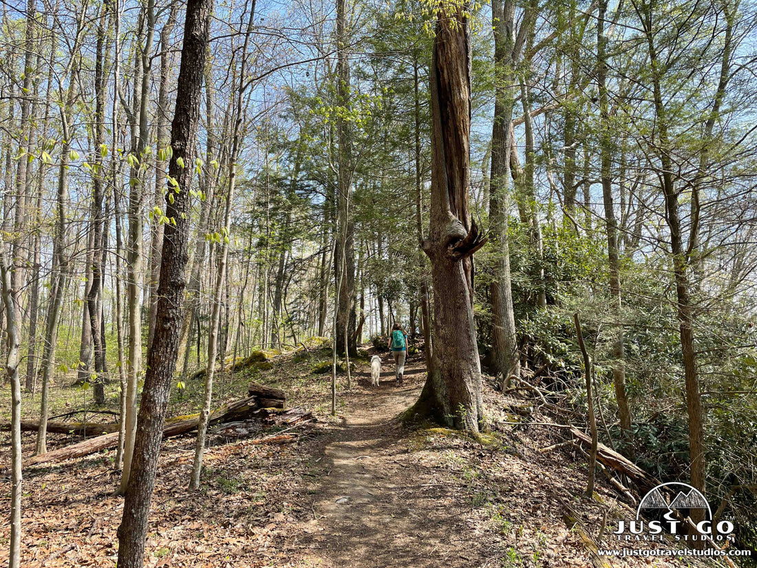
If you are in the area for more than a couple hours, then taking the time to go hiking in Caledonia State Park is a must do! The park has quite a few hikes to choose from, and many of the trails intertwine, allowing you to make up your own routes based on how much time you have and how much energy you have left in you!
In this article, we’ll cover the best hiking trails in Caledonia State Park, directions on how to get to each trailhead, elevation gain and difficulty as well as how to be best prepared for your time on the trails in the park. If you are looking for more information on the park as a whole, then head to our article on Things to Do in Caledonia State Park.
HIKING IN CALEDONIA STATE PARK: PREPARATION
Hiking in Caledonia State Park isn’t overly specialized. Still, there are a few things that you need to do to be best prepared to do your hike safely and comfortably.
- The trails are well marked and relatively short, but we do recommend taking a photo of the hiking trail maps. This will help you navigate your way to and from the start of your hike, especially when you reach trail junctions.
- We recommend hiking shoes or hiking boots on most of the trails, and that’s because it’s not abnormal for the trails to be a bit muddy or some of the rocks to be slippery. Sturdy shoes will help you ensure that you’ll be safe and prevent injury, whether it be a twisted ankle or a scrape from slipping.
- The bugs in the park can be particularly challenging in the early part of the summer. We highly recommend bringing some good bug spray.
- Hiking on these trails in the summer can be hot and the humidity can be through the roof, so be sure you bring more water than you think you should.
HIKING TRAILS IN CALEDONIA STATE: TRAIL DESCRIPTIONS AND TRAIL MAPS
APPALACHIAN TRAIL
- Difficulty: Moderate
- Distance (round-trip): 3.6 miles
- Elevation gain: 370 feet
- Hiking time (approximate): 2 hours
- Trail type: Out-and-back
- Potential hazards: Bugs, rocky trail
- Restrooms: Toilets located at the trailhead.
- Recommended footwear: Hiking shoes or hiking boots.
- Pets: Allowed, but must be kept on a leash at all times.

Appalachian Trail map, courtesy of the Pennsylvania Department of Conservation and Natural Resources
Trail Description
Take the opportunity to head out on a portion of the Appalachian Trail! This short hike departs the main parking lot and heads north. Immediately after departing the parking area you’ll start to head up. The bulk of the elevation gain on this trail happens in the first 0.5 miles, before easing up as you continue to head north.
At the 0.9-mile point, the trail heads sharply to the east and Chinquapin Hill before getting to the park border. From here you can keep going for as long as you want-seriously, if you want to hike to Maine, you can! But even just hiking a bit into Michaux State Forest is a good idea. If you hike about 0.9-miles past the park border and then into Michaux State Forest, on the right you’ll be able to head up another 0.4 miles to the peak of Quarry Gap Hill, which has some great views to the southeast in particular.
When you return, you can head right back on the route you came or take the Three Valley Trail to the Chambersburg Water Line Trail. This extends the hike by about 0.5-miles, but it’s nice to take a bit of a different route with a slightly less steep incline.
Trailhead Directions
The trailhead starts at the parking area for the picnic pavilions on the left side after you enter the park.

CHARCOAL HEARTH TRAIL
- Difficulty: Moderate
- Distance (round-trip): 2.8 miles
- Elevation gain: 615 feet
- Hiking time (approximate): 1.5 hours
- Trail type: Loop
- Potential hazards: Bugs, rocky trail
- Restrooms: Toilets located at the trailhead.
- Recommended footwear: Hiking shoes or hiking boots.
- Pets: Allowed, but must be kept on a leash at all times.

Charcoal Hearth Trail map, courtesy of the Pennsylvania Department of Conservation and Natural Resources
Trail Description
The trail departs to the east from the parking area. You have two options for how to hike this loop, and we recommend taking the fork to the right to get the climbing done at the beginning of the hike.
The trail takes off steeply in the first 0.2-miles before easing up a bit as it continues to climb the rest of the 615 feet up to the top of Graefenburg Hill. From here you’ll have some nice views to the southeast before starting your descent.
On the way down you’ll pass by the sites of 4 charcoal kilns that were used in the 1800’s. There isn’t much left other than the pads that were used for the kilns, but they are still pretty interesting to see.
The trail then meets up and travels along Pine Grove Road as it makes its way back to the trailhead.
Avoid the urge to wear sandals-this is the most challenging trail in the park and the climbing gets a bit steep, so you’ll want to be sure you have good footwear to improve the chances of hiking without injury!
Trailhead Directions
The trailhead starts at the parking area on the right side of the main park entrance, before you get to the park office.
RAMBLE TRAIL
- Difficulty: Easy
- Distance (round-trip): 2.8 miles
- Elevation gain: 50 feet
- Hiking time (approximate): 1.5 hours
- Trail type: Loop
- Potential hazards: Bugs
- Restrooms: Toilets located at the trailhead.
- Recommended footwear: Closed-toed shoes.
- Pets: Allowed, but must be kept on a leash at all times.

Ramble Trail map, courtesy of the Pennsylvania Department of Conservation and Natural Resources
Trail Description
If you are looking for something that is a bit of a longer walk but without too much elevation gain, this is it! The Ramble Trail provides a nice walk along Conocheague Creek before heading into the forest after a bridge crossing.
After departing the parking area and heading south over the creek for the first time, take a right and follow the Ramble Trail along the creek. Here you’ll likely encounter fly fisherman test their skill against the native trout.
Cross the river again at the 0.9-mile point before heading back to the east and the parking area.
Trailhead Directions
The trailhead begins at the picnic area parking, which is the second large lot on the left side after you enter the park.
MIDLAND TRAIL
- Difficulty: Easy
- Distance (round-trip): 1.1 miles
- Elevation gain: 30 feet
- Hiking time (approximate): 30 minutes
- Trail type: Out-and-back
- Potential hazards: Bugs
- Restrooms: Toilets located at the trailhead.
- Recommended footwear: Closed-toed shoes.
- Pets: Allowed, but must be kept on a leash at all times.

Midland Trail map, courtesy of the Pennsylvania Department of Conservation and Natural Resources
Trail Description
This is one of the easier trails in the park. After departing from the main parking area, the trail passes through a dense forest. The trail ends at the group camping area.
For a couple of interesting diversions, take a right at the 0.5-mile point and head to the Furnace Dam. You can also head to the north before you get to the group campground and then return on the Chambersburg Water Line Trail, making it a nice loop that extends the hike only by about 0.15-miles.
Trailhead Directions
The trailhead begins on the east side of the entrance area near the Forest Heritage Discovery Center.
THADDEUS STEVENS HISTORIC TRAIL
- Difficulty: Easy
- Distance (round-trip): 0.8 miles
- Elevation gain: 40 feet
- Hiking time (approximate): 30 minutes
- Trail type: Out-and-back
- Potential hazards: Bugs
- Restrooms: Toilets located at the trailhead.
- Recommended footwear: Closed-toed shoes
- Pets: Allowed, but must be kept on a leash at all times.

Thaddeus Stevens Historical Trail map, courtesy of the Pennsylvania Department of Conservation and Natural Resources
Trail Description
This short trail helps you travel through time to see signs and landmarks that show you what was set up here during the height of the Iron Works production. The trail is short and meandering, and a good way to spend a few minutes learning about the history of the area.
Be sure to download a copy of the trail guide, which provides information about the landmarks on the trail.
Trailhead Directions
The trailhead starts just behind the Forest Heritage Discovery Center.
CHAMBERSBURG WATER LINE TRAIL
- Difficulty: Easy
- Distance (round-trip): 3.8 miles
- Elevation gain: Minimal
- Hiking time (approximate): 2 hours
- Trail type: Out-and-back
- Potential hazards: Bugs
- Restrooms: Toilets located at the trailhead.
- Recommended footwear: Closed-toes shoes
- Pets: Allowed, but must be kept on a leash at all times.

Chambersburg Water Line Trail map, courtesy of the Pennsylvania Department of Conservation and Natural Resources
Trail Description
This is another easy trail that’s great for families! The trail extends the entire width of the park, from the Hosack Run Campground to the western border of Caledonia State Park.
The trail is great for getting to the swimming area from the easterly Hosack Run Campground, or for taking a light walk to explore a bit of the forest. You won’t have any broad views, but it’s still a nice trail to take. You can also just walk a portion of the trail quite easily.
Trailhead Directions
The trailhead can be picked up in a variety of locations. This can be the Hosack Run Campground, one of the main parking areas near the picnic pavilions, heading down the hill from Chinquapin Hill Campground or by hiking on the Ramble Trail.
TROLLEY TRAIL
- Difficulty: Easy
- Distance (round-trip): 1.4 miles
- Elevation gain: Minimal
- Hiking time (approximate): 45 minutes
- Trail type: Out-and-back
- Potential hazards: Bugs, bicycle traffic
- Restrooms: Toilets located at the trailhead.
- Recommended footwear: Sandals or closed-toed shoes.
- Pets: Allowed, but must be kept on a leash at all times.

Trolley Trail map, courtesy of the Pennsylvania Department of Conservation and Natural Resources
Trail Description
This flat, multi-use trail follows the old trolley rail line that was used to bring visitors to the area. This is a great place to take a relaxing walk and also check out the old Blacksmith Shop. Just keep your eyes out for bicyclists who also use this trail.
Trailhead Directions
The trailhead starts on the west side of PA-233, just south of the main entrance station.
Additional smaller trails are also available, and we recommend seeing the Caledonia State Park hiking map for more information.
ARE PETS ALLOWED ON THE TRAILS AT CALEDONIA STATE PARK?
Yes! Pets are allowed, but must be kept on a leash at all times.
WHEN IS THE BEST TIME OF YEAR TO HIKE IN CALEDONIA STATE PARK?
You can hike any time of year in Caledonia State Park, but the two best times to hike (in our opinion) are the later summer and fall. As the summer wanes so do the bugs, so getting out here in later August is ideal. In the fall the colors start to change, making this a spectacular place to explore with a little less heat and humidity.
If you do want to hike here in the spring, just be sure to bring rain gear and expect the trails to be a bit wet and muddy.
HIKING IN CALEDONIA STATE PARK IN THE WINTER
Hiking here in the winter is terrific, as long as you are prepared. Expect each trail to take about 35% longer in the winter as it might in the summer. The biggest thing to be aware of is the ice. The trails can get icy, making it super helpful to have micro spikes with you. Also be sure to bring plenty of warm clothing (in layers) and drink plenty of water.
FURTHER INFORMATION ON CALEDONIA STATE PARK FROM JUST GO TRAVEL STUDIOS
- Be sure to also check out our articles on Things to Do in Caledonia State Park as well as Camping in Caledonia State Park.
- Caledonia State Park is next to the large Michaux State Forest, which you can read about in our blog on Things to Do in Michaux State Forest.
- Upon getting back from your vacation in Pennsylvania, check out how we can make a custom, vintage-style poster using photos that you send to us!