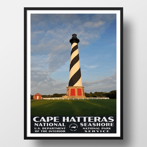
Separating the Atlantic Ocean from the Pamlico Sound, Cape Hatteras National Seashore is a long, narrow stretch of islands that make up about 70 miles of North Carolina coastline. The seashore consists of three islands: Hatteras Island, Bodie Island to the north and the remote Ocracoke Island to the south.
It takes a bit of time and effort to get to Cape Hatteras National Seashore. You won’t find large commercial airports on the seashore, and the roads leading in are narrow and seem to last forever. But for those who make the effort, what awaits is many miles of unspoiled beaches, towering lighthouses to explore, incredible fishing, a sometimes rugged and always beautiful ocean and hours or days of relaxation.
It really is possible to spend a full week exploring the area, especially if you include the other part of the Outer Banks to the north (including the Wright Brothers National Memorial). Whatever amount of time you have and whatever your pace of travel, Cape Hatteras National Seashore is a must-see, and you’ll find plenty to do here to match to your needs and wants!
While there is a lot of information available on the Outer Banks of North Carolina in general, we hope that this guide fills you in on what really are the best things to do at Cape Hatteras National Seashore!
CAPE HATTERAS NATIONAL SEASHORE HISTORY
Cape Hatteras has long been known by Mariners as the “Graveyard of the Atlantic,” as there have been an inordinate number of shipwrecks for as long as boats have been traveling along the nearby coastline. This is mainly due to the churned-up waters that are from the Gulf Stream interacting with the Arctic Current. The result is a constantly changing coastline and sand bar location, making it challenging to navigate. In fact, the estimate is that there are more than 2,000 shipwrecks off the coast of the National Seashore. You can read more about the shipwrecks off the coast here.
Cape Hatteras was designated as a National Seashore in 1953, but it was actually protected by the State of North Carolina in 1935 in preparation to be turned over to the National Park Service.
Today the park encompasses over 30,000 acres and attracts over 2 million visitors annually.
THINGS TO DO IN CAPE HATTERAS NATIONAL SEASHORE
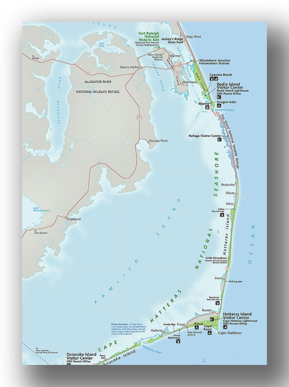
Cape Hatteras National Seashore map, courtesy of the National Park Service
While there are certainly things to do that are particular to each island, there are some things that you can do on any of the islands. For instance:
- Hanging out on the beach. By far, the most popular thing to do in Cape Hatteras is to relax on the beach. This may include just soaking up the sun or going for a walk. You can walk for as short or long as you want. The beaches here really are pristine, and there are a ton of parking areas in which to pull over. We recommend checking out a few stops each day you are there-really, just stop at whatever place looks good. We cover some specific locations on each island later on in this article.
- Swimming. Swimming in Cape Hatteras is great. The water is fairly shallow. However, just be advised that the waves can be quite strong, and there are rip currents. There are four lifeguarded beaches in total (again, covered specifically later in this blog), and we recommend doing most of your swimming there to provide extra protection.
- Fishing. Fishing in Cape Hatteras National Seashore is well-known and is quite amazing. Most people fish right from the shore, but you can also fish from the docks. There is a pier at Avon (fee-based) and a free pier at the Oregon Inlet (Bonner Bridge Pier). Be advised that if you do fish, you have to have a North Carolina state fishing license.
- Drive an Off-Road Vehicle. You may drive vehicles in designated areas (and there are a ton) along the seashore. You are required to obtain a permit, and there are special rules that you need to follow. See this site for information on off-road vehicle access.
HATTERAS ISLAND
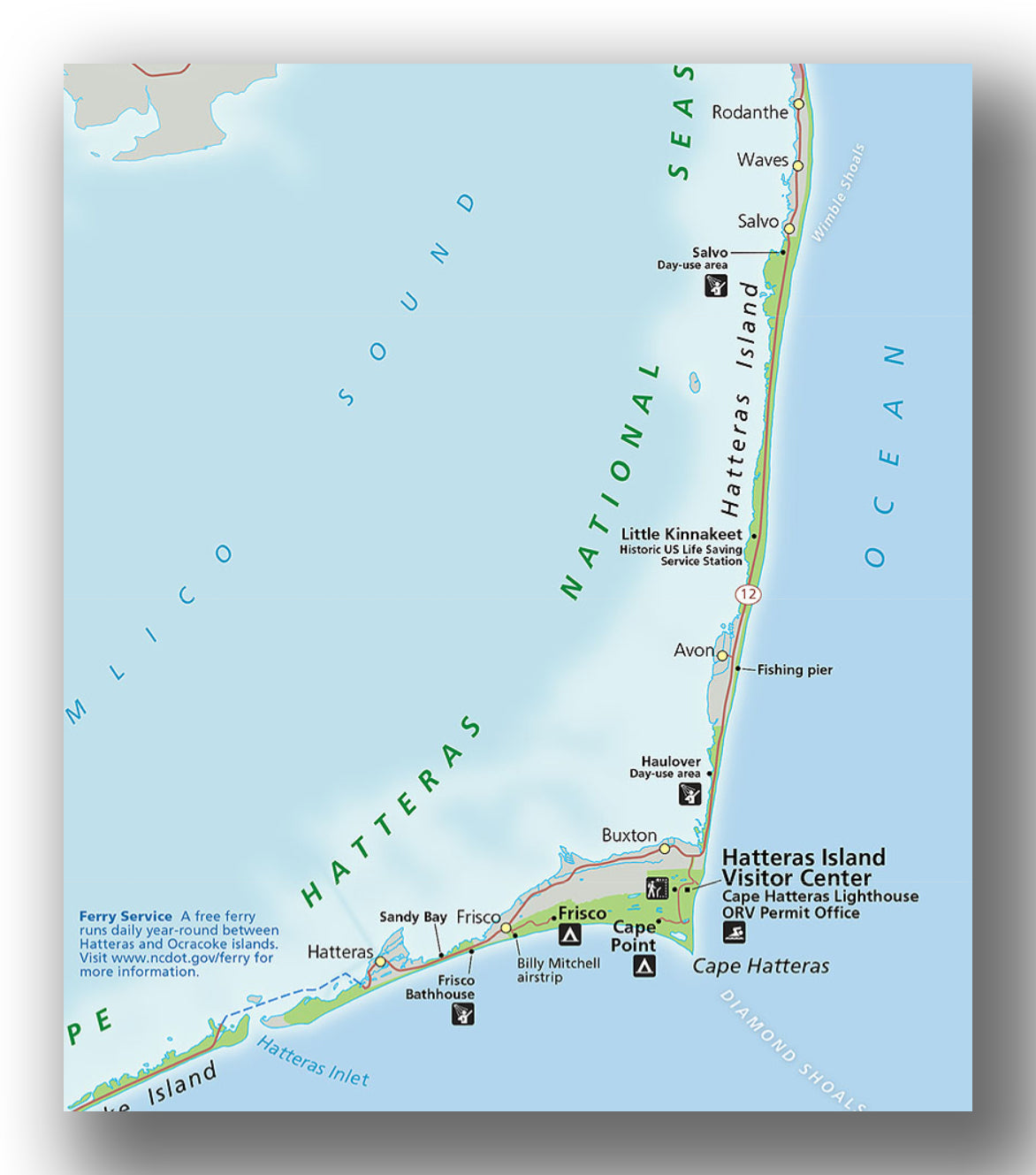
Hatteras Island map, courtesy of the National Park Service
Accessible by bridge from Bodie Island, Cape Hatteras Island is the largest of the three islands in the National Seashore. In fact, it’s over 50 miles long. Plan on spending at least a day driving around and viewing the beaches. Or, if you are up for it, spend a few days here just relaxing and enjoying the beaches!
When visiting Hatteras Island, our recommendations for activities include:
-
Beaches on Hatteras Island:
- Frisco Beach. Frisco Beach is a lifeguarded beach located just south of the “elbow” of Hatteras Island. The water is a bit warmer at the south beaches, and Frisco is one of these.
- Old Lighthouse Beach. Old Lighthouse Beach is also lifeguarded and located just north of the “elbow” of Hatteras Island. This is a great place to surf (or watch surfers!). You can also check out the old site of the lighthouse before it was moved to its current location in 1999.
- Haulover Day Use Area. Located on the Pamlico Sound side of the island, Haulover is a great place to go and watch the kite boarders and windsurfers. It’s also a popular beach spot for families, though it is not monitored by lifeguards.
- Sandy Bay. Located at a narrow spot of the island, Sandy Bay gives access to the Pamlico Sound and the Atlantic Ocean sides. There aren’t any services, but it’s a good place to check out.
- Salvo Day Use Area. This is a quiet location that is usually not crowded at all. It’s a good spot for swimming or watching windsurfers, kite boarders or getting in a kayak yourself!
- Hatteras Island Visitor Center. Open year-round, this is a great place to stop to learn about the area and get the latest conditions from the Rangers. It is located near the Cape Hatteras Lighthouse. There is a small museum that contains exhibits about the Outer Banks history and is quite interesting!
- Cape Hatteras Lighthouse. One of the more popular places to visit in the area is the famous Cape Hatteras Lighthouse. This is actually the second lighthouse built here. The first lighthouse was first lit in 1803, and the current lighthouse was built as an upgrade and lit in 1870. Restoration efforts are underway, and climbing up into the lighthouse is not possible until those efforts are complete. However, the grounds are beautiful, the lighthouse is extremely picturesque and the area is worth visiting.
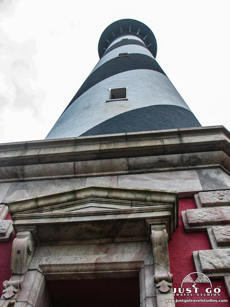
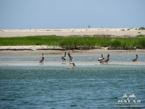
- Pea Island National Wildlife Refuge. The Pea Island National Wildlife Refuge takes up 13 miles of the northern side of Hatteras Island and is set aside for migrating birds and waterfowl. There are more than 350 species that travel through the refuge. The visitor center is a great place to start your visit, and you can learn all about what to expect during your time here. If you are at all interested in wildlife, plan on heading here and spending a few hours at least!
- Little Kinnakeet Life-Saving Station. Originally placed in service in 1874, this historic lifesaving station consists of a boathouse. You can see the boathouse from a distance, but you cannot visit the grounds directly.
-
Hiking. Most of the hikes in the area are very flat. You can expect some sand on the trails, and they are all leave hikers very much exposed to the elements. Be sure to bring bug spray, sunblock and plenty of water. Some recommendations include:
- The Open Ponds Trail (8.9 miles round-trip) is a moderate hike. The flat trail passes by Open Pond at about 1.2 miles into the hike. Expect a lot of bugs! The Open Ponds Trail begins near the Commonwealth Graves site on Lighthouse Road, just west of the Cape Hatteras Light Station.
- The Buxton Woods Trail (0.75-miles round-trip) heads through a variety of forest plants along a marsh. There are interpretive signs along the trail. The Buxton Woods Trail is located just north of the Cape Hatteras Light Station.
- The North Pond Wildlife Trail heads on the south side of North Pond in the Pea Island National Wildlife Refuge. At only 1.2-miles (round-trip), this out-and-back trail provides great opportunities for seeing wildlife. The North Pond Wildlife Trail heads west from the Pea Island National Wildlife Refuge Visitor Center. You can also continue to the north along the pond for another 3.2 miles (round-trip).
BODIE ISLAND
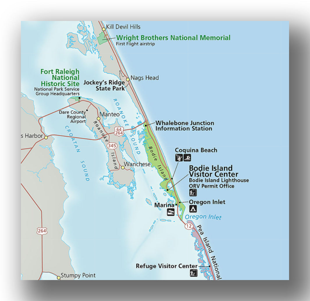
Bodie Island map, courtesy of the National Park Service
The easiest to get to part of the Seashore, Bodie Island is the most common entry point to the Cape Hatteras National Seashore. It’s a small area, but there are still a few things to do:
-
Beaches on Bodie Island:
- Coquina Beach. Located on Highway 12 (across from Bodie Island Lighthouse), Coquina Beach is a lifeguarded beach that is worth checking out.
- Bodie Island Visitor Center. This visitor center is open year-round and offers a store and find out about the state of the park. There is also a small store and a short boardwalk that overlooks a marsh.
- Bodie Island Lighthouse. Though perhaps not as famous is the Cape Hatteras Lighthouse, the Bodie Island Lighthouse is certainly beautiful! This 150-year-old lighthouse is open for climbing in the summer months. Be prepared, as there are over 200 steps to get to the top. Tickets can be purchased online.
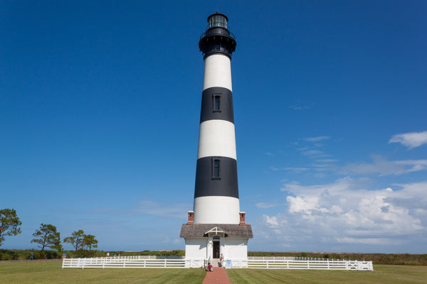
Bodie Island Lighthouse, image courtesy of Kip Robinson
OCRACOKE ISLAND
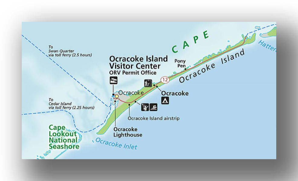
Ocracoke Island map, courtesy of the National Park Service
Ocracoke Island is the southernmost island in Cape Hatteras National Seashore. It’s 16 miles long and quite narrow. Getting here takes a bit of planning and time, as there are no roads to be able to drive directly to the island.
HOW DO YOU GET TO OCRACOKE ISLAND?
To get to Ocracoke Island, visitors are required to use one of three ferries:
- The Hatteras Inlet Ferry is the most popular ferry and runs from Hatteras Village to the northernmost tip of Ocracoke Island. The ferry is free, takes about 45 minutes and doesn’t require reservations.
- Leaving from Sea Level, NC and connecting with Ocracoke Village is the Cedar Island Ferry. This takes about 135 minutes, and you are required to have reservations.
- The final option is to take the Swan Quarter Ferry, which connects Swan Quarter to the Ocracoke Village. This takes about 150 minutes, and reservations are required.
We recommend staying on Ocracoke Island for at least a day (to make the trip out here worth it), and while you are there, here a few recommendations:
-
Beaches on Ocracoke Island:
- Ocracoke Beach. Located on the southern end of the island, Ocracoke Beach has some of the warmest water in the seashore. This is a great place to hang out with the security of lifeguards.
- Pony Pasture Beach. Located a bit north of Ocracoke Beach, this isolated area has picnic tables, dunes and stillness that is not on the more crowded Ocracoke Beach.
- Ocracoke Island Visitor Center. Open only between March and October (and intermittently the rest of the year), there are some great exhibits to check out, as well as rangers standing by to provide information
- Ocracoke Lighthouse. This lighthouse was erected in 1823 and is still standing today! It’s 75 feet tall and made of brick and is still in service today. While you can’t climb up or go into the lighthouse, the grounds are open for visitation.
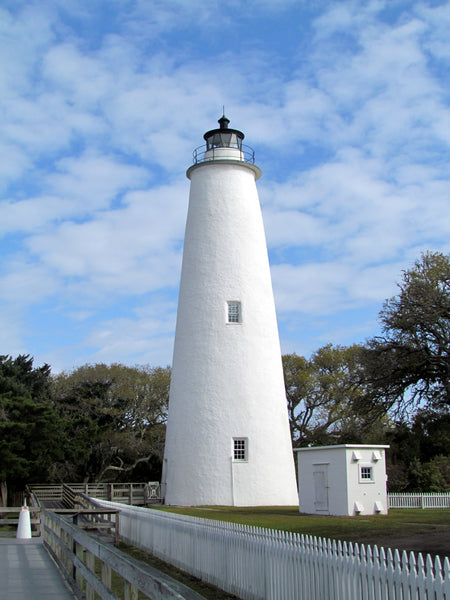
Ocracoke Island Lighthouse, image courtesy of bobistraveling
WHAT IS THERE TO DO NEAR CAPE HATTERAS NATIONAL SEASHORE?
As you can imagine, the Outer Banks of North Carolina has a ton to do. We generally focus on the public lands to explore in the area, and our recommendations include the following:
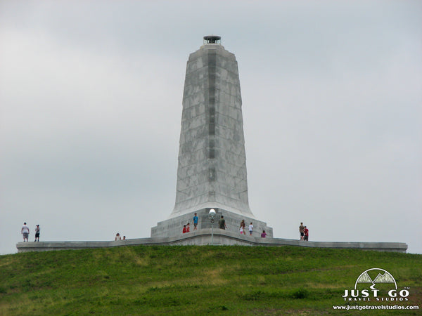
- Head to the Wright Brothers National Memorial. Here you can see where the first airplane flight was by the Wright Brothers. They have a wonderful visitor center that shows the history of the flight (and how they achieved it), the camp buildings and you can see the path the first flight took. The Wright Brothers National Memorial is located about 15 miles north of the Bodie Island Visitor Center on Highway 158.
- The Fort Raleigh National Historic Site is worth checking out as well. It showcases England’s first settlement in North America. The Fort Raleigh National Historic Site is located on Roanoake Island, just west of the National Seashore and only 15 miles from the Bodie Island Visitor Center.
ENTRANCE FEES AND REQUIRED PASSES FOR CAPE HATTERAS NATIONAL SEASHORE
There is no entry fee into Cape Hatteras National Seashore, and no reservations offered or required.
WHERE TO STAY WHEN VISITING CAPE HATTERAS NATIONAL SEASHORE
Cape Hatteras National Seashore Lodging: There are no hotels or lodging inside of Cape Hatteras National Seashore. There is a multitude of lodging options on Hatteras Island, Bodie Island and several options on Ocracoke Island. Book well in advance if planning on visiting here between March through May.
CAPE HATTERAS NATIONAL SEASHORE CAMPING
There are several great camping options inside of Cape Hatteras National Seashore. Here are a few options to consider:
Oregon Inlet Campground:
- Location: The Oregon Inlet campground is located on the southern end of the northernmost part of Cape Hatteras National Seashore, Bodie Island. Directions from the Bodie Island Visitor Center to Oregon Inlet Campground.
- Accessible via: Vehicle.
- Reservations: Offered year-round. Oregon Inlet Campground Reservations.
- Capacity: 107 sites.
- Electricity / Water Hookups / Dump Station: Yes / Yes / Yes.
- Toilets / Showers: Flush toilets and showers.
- Additional details: This campground is well rated, and routinely thought of as the best campground in Cape Hatteras National Seashore. It’s a short walk to the beach, and the facilities are kept very clean.
Cape Point Campground:
- Location: The Cape Point Campground is located right at the “elbow” of Hatteras Island, near the Cape Hatteras Lighthouse. Directions from Cape Hatteras Lighthouse to Cape Point Campground.
- Accessible via: Vehicle.
- Reservations: Offered from early-March through late November, offered on a 4-day rolling basis. Cape Point Campground Reservations.
- Capacity: 202 sites.
- Electricity / Water Hookups / Dump Station: No / No / No.
- Toilets / Showers: Flush toilets and showers.
- Additional details: The Cape Point Campground is has open sites and is located right near the beach in Hatteras Island. It’s rarely full, but be sure to check out the weather conditions ahead of your visit as it can be soaked with water in some of the campsites.
Frisco Campground:
- Location: The Frisco Campground is located about 6 miles to the west of the Cape Hatteras Lighthouse on Hatteras Island. Directions from Cape Hatteras Lighthouse to the Frisco Campground.
- Accessible via: Vehicle.
- Reservations: Offered from early-April through late November. Frisco Campground Reservations.
- Capacity: 127 sites.
- Electricity / Water Hookups / Dump Station: No / No / No.
- Toilets / Showers: Flush toilets and showers.
- Additional details: The Frisco campground has sites that are protected by trees and a ton of great places to stay.
Ocracoke Campground:
- Location: The Ocracoke Campground is located about 9 miles south of the Ocracoke Island Ferry Terminal on the north side of the island. Directions from the Ocracoke Island Ferry Terminal to the Ocracoke Campground.
- Accessible via: Vehicle.
- Reservations: Offered year-round. Ocracoke Campground Reservations.
- Capacity: 136 sites.
- Electricity / Water Hookups / Dump Station: No / No / No.
- Toilets / Showers: Flush toilets and showers.
- Additional details: The Ocracoke Campground has a lot of sites that are very open. It is rarely full (due to the work that it takes to get here) but is a great spot to stay and get access to the beach for a day or more.
BEST TIME TO VISIT CAPE HATTERAS NATIONAL SEASHORE
There are a few things to weigh when you are trying to figure out the best time of the year to visit Cape Hatteras National Seashore.
First of all, the seashore is beautiful during all months of the year. Whether it’s warm sunshine and clear days, or a rugged looking day in the winter, it’s an amazing place.
While hurricanes can develop and hit this area anytime between June and November, the majority of the hurricanes happen in September or October. If you plan to visit during this time, just keep an eye on the weather ahead of and during your visit.
The summer months bring heat and crowds. This is a great time to spend on the beach, but it can be a bit overwhelming if you are not expecting it. Plus, rates for lodging go up significantly.
The spring and fall are great times, with weather being mild and crowds being low.
Don’t let any of these “warnings” dissuade you from going to this area-just be aware of them and be prepared to manage the crowds if you are here in the busy months.
VISITING CAPE HATTERAS NATIONAL SEASHORE IN THE WINTER
The winter is a great time to visit, though be advised that there is limited camping, the weather is a bit colder and some of the visitor centers are closed or have limited hours. The frequency of the ferry from Hatteras to Ocracoke Island is a bit less as well, but it is still operating.
ARE PETS ALLOWED IN CAPE HATTERAS NATIONAL SEASHORE?
Pets are allowed at Cape Hatteras National Seashore. They must be kept on a leash the entire time and are not allowed on swim beaches or in buildings.
RELATED INFORMATION ON CAPE HATTERAS NATIONAL SEASHORE AND THE SURROUNDING AREA FROM JUST GO TRAVEL STUDIOS
- North Carolina has a ton to offer, and you should consider a visit inland to Great Smoky Mountains National Park. Our itinerary is downloadable and may be of interest!
- We offer posters of public lands, including this WPA Style Poster of Cape Hatteras National Seashore.
- When you return from your trip to the Outer Banks, send us a few images so we can make you an amazing custom, vintage travel poster. We will include custom wording an put it in our vintage style. It’s truly unique and you’ll love it, guaranteed!


