There is no doubt that visiting Crater Lake National Park will leave you awestruck, even if you only visit the pullouts easily accessible by your vehicle. But if you want to get some even more incredible views, we highly recommend getting out on one of the trails. You may not have realized that there really is some great hiking in Crater Lake, so to help you out we put together this list of what we consider to be the best hikes in Crater Lake National Park!
The best news is that there are a variety of hikes to head out on, from very easy ones that will take only about 30 minutes, to more demanding hikes that will take the better part of the day. And with the temperatures staying moderate through the summer, you won’t have to worry too much about it being too hot when you hike (though you may have to worry about the snow!).
While there are more than seven great hikes in Crater Lake to choose from, we think this selection offers the best variety-you’ll get to see amazing views of the lake, but also of interesting formations from lava runoff.
Do you have any others that you think we missed? Let us know!
CRATER LAKE NATIONAL PARK HIKING: DISTANCES AND ELEVATION GAIN
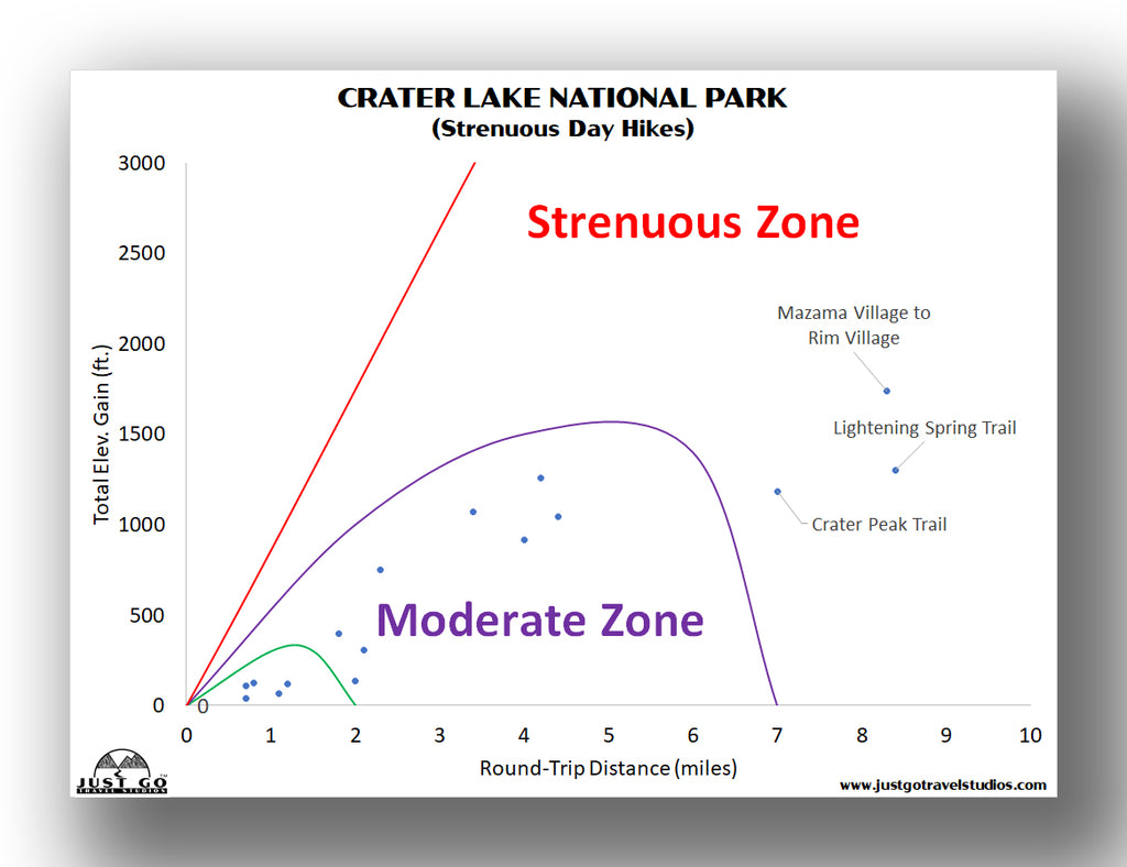
To help out, we put together an overview of the most common hikes in Crater Lake National Park. These charts plot the total elevation gain of a hike against the round-trip distance. We then categorized each hike based on that information (and a few other pieces of data) to help narrow down the right hike (or hikes) for you and your travel partners.
If easy hikes are in your wheelhouse (or if you need a hike or two after you did a more challenging hike), here are a few easy hikes to consider.

For more moderate hikes, usually doable by most active families, this graph will give you a few to try.

Finally, if you want something a bit tougher, here are some strenuous hikes to consider.
Our Crater Lake National Park Itinerary will help you plan out your entire visit to the park. We discuss where to stay, what to see in the area, hiking maps (including what you see in this blog and more), what to pack and the great sights to see along your visit.
BEST HIKES IN CRATER LAKE NATIONAL PARK: TRAIL DESCRIPTIONS AND TRAIL MAPS
GARFIELD PEAK TRAIL
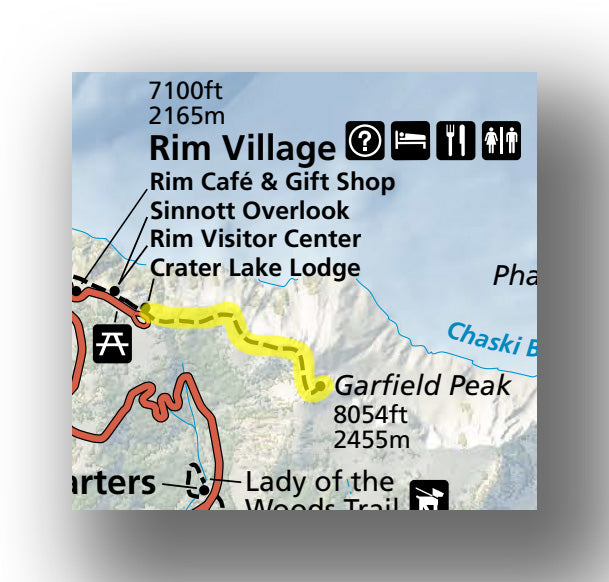
Garfield Peak Trail map, courtesy of the National Park Service
If you are in the mood for something a bit challenging but without being an all-day hike, the Garfield Peak Trail is a great one to consider. This is one of the most popular trails in the park for those that like to hike, due to its proximity to the Rim Village Visitor Center and the major “hub” of activity in the park, as well as its amazing views.
The Garfield Peak Trail is a moderately challenging 3.3-mile (round-trip) trail that climbs just over 1033 feet. After walking down a short paved trail, you’ll head up a set of switchbacks and have near-constant views of Crater Lake. The panoramic views up from the top are hard to beat. From here you will be able to see Crater Lake (of course!) as well as Phantom Ship, which is a small island created during an eruption after the main crater was created.
The hike is not overly challenging, but it is pretty steep and can be very tiring, particularly at this elevation. But it’s totally worth it! Expect the hike to take about 2 hours total.
The trailhead is located at the southeast corner of Crater Lake Lodge.
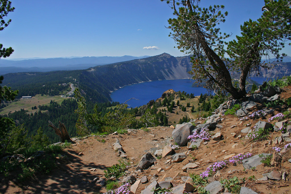
Garfield Peak, photo courtesy of Markgorzynski
CLEETWOOD COVE TRAIL

Cleetwood Cove Trail map, courtesy of the National Park Service
The Cleetwood Cove Trail is a moderately challenging (but short!) 1.9-mile (round-trip) hike that has a total elevation gain of about 700 feet. While the steepness of this hike may make you wonder why people hike it, it’s quite popular as it’s the only way to get down to the water’s edge at Crater Lake. It’s also the only way to get to a boat if you plan on taking a cruise or a trip back and forth from Wizard Island.
The trail begins from the park loop road, and heads down a series of switchbacks. The dirt trail is not challenging at all on the way down-within about 20 minutes the trail arrives at the Cleetwood Cove boat launch. Here you can use the restroom, hop on a cruise (if you have reservations) or actually go for a swim! We also enjoyed watching hikers jump into the lake off a short cliff.
While the water is super clear, it’s also very cold! If you head here on a hot day, though, it can be quite refreshing.
The hike back up can be challenging and get your heart beating, even if you are in the best of shape. There were quite a few people on the trail, and while some had to stop and take a break multiple times,
The trailhead is located 4.5-miles east of the North Junction on Rim Drive. There is a parking area across the road.

MOUNT SCOTT TRAIL
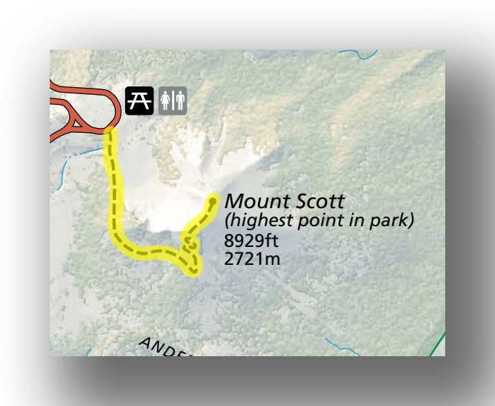
Mount Scott Trail map, courtesy of the National Park Service
Away from Rim Drive is a hike to the tallest point in the park, the Mount Scott Trail. This moderately challenging hike is a 4.3-mile (round-trip) trail that climbs nearly 1300 feet.
The hike is not overly difficult, as most of the climb is fairly gradual. Along the way (and when you get tot the top) you’ll be rewarded with amazing views of the lake and the surrounding mountains! Bring a jacket, though, as it can get quite cold at the top, even in the summertime.
The trailhead is located 10.9 miles east of the North Junction, or 12.1 miles east of the Steel Visitor Center on Rim Drive.
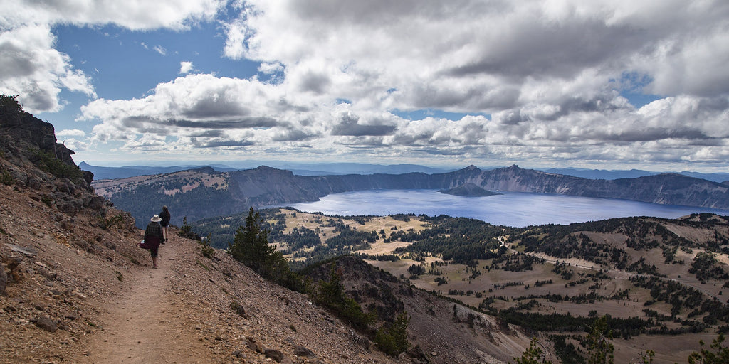
Mount Scott Trail, image courtesy of Mark Gorzynski
SUN NOTCH TRAIL
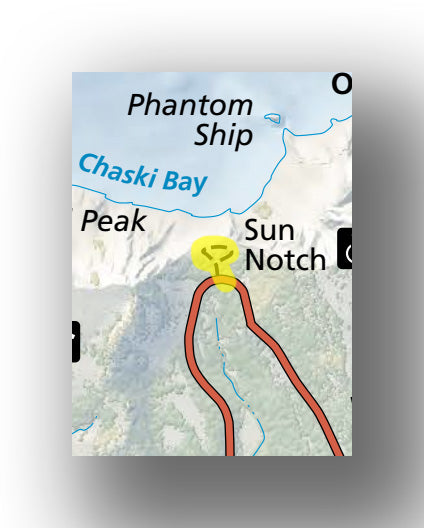
Sun Notch Trail map, courtesy of the National Park Service
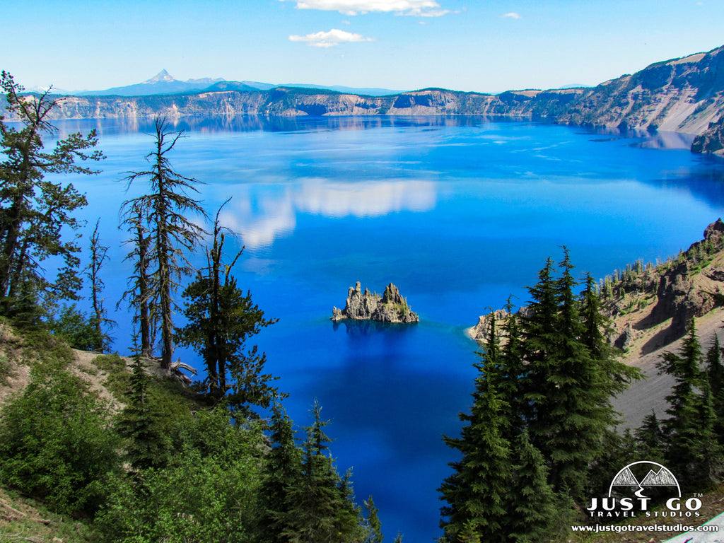
The easiest trail on this list of best hikes in Crater Lake National Park, the Sun Notch Trail is a short, 0.8-mile (round-trip) loop trail that climbs just about 120 feet. While the hike is super short, it contains a beautiful view of Phantom Ship (a small rock outcropping in the water) as well as just some incredible views of Crater Lake.
After a brief hike through the forest, the loop stops at the overlook of the lake. On the way back you’ll be through the forest again, and if you are watchful you can glimpse wildlife in the woods, including the potential to see deer.
The only thing you need to be careful of on this hike is the parking lot is very small and hard to see. IFfyou end up getting here early in the morning (which we recommend), there will be a good chance that you’ll be on your own and have the best chance of seeing wildlife.
The trailhead for the Sun Notch Trail is located 4.3 miles east of the Steel Visitor Center (keep your eye out, though, as the parking area can be really easy to miss!).
WATCHMAN PEAK TRAIL

Watchman Peak Trail map, courtesy of the National Park Service
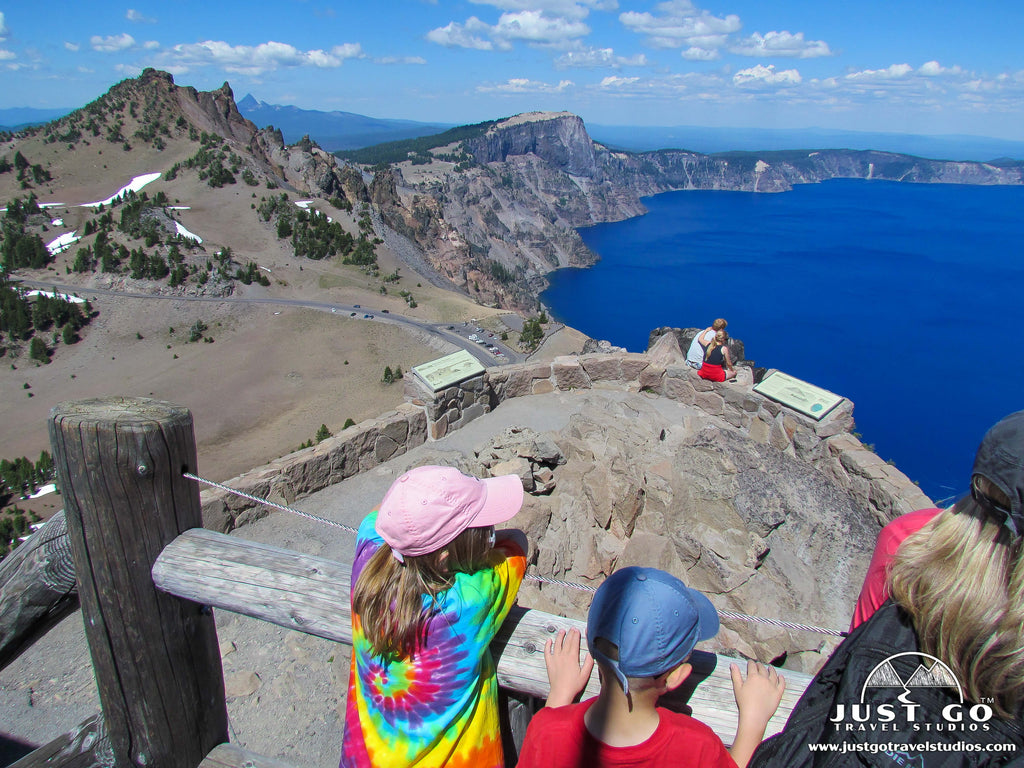
Situated near the Rim Village Visitor Center area on Rim Drive, the Watchman Peak Trail is an excellent short hike. This 1.8-mile (round-trip) trail is moderately difficult, mainly because of the climb up 390 feet.
After heading south on the side of a mountain, the trail ascends through a small forest via switchbacks. The endo the trail has an old fire watchtower. From the watchtower you’ll have great views of the lake and Wizard Island. It’s also a great spot to relax and have a picnic.
The trail can get crowded due to its short lake, easy elevation gain and proximity to the most popular parts of the park. We recommend taking this hike in the early morning for sunrise or in the late afternoon so you have the sun at your back for incredible pictures of the lake.
The Watchman Peak trailhead is located 3.6 miles north of the Rim Village Visitor Center. There is a large parking area as it shares a parking lot with an overlook.
PLAIKNI FALLS TRAIL
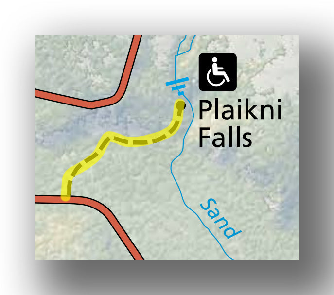
Plaikni Falls Trail map, courtesy of the National Park Service
Located off the beaten path down Pinnacles Road, the Plaikni Falls Trail is a 2.0-mile (round-trip) trail that has only about 130 feet of elevation gain.
This easy trail heads through a forested path which leads to Sand Creek an Plaikni Falls. This trail is not heavily traveled at all. It can be buggy, though, so be sure you bring your bug spray!
The trailhead for the Plaikni Falls Trail is located 1.1 miles down Pinnacles Road, which is about 8.3 miles east of the Steel Visitor Center.
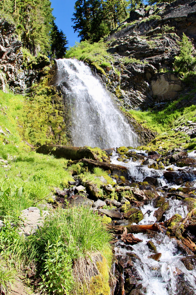
Plaikni Falls, image courtesy of daveynin
PINNACLES TRAIL

Pinnacles Trail map, courtesy of the National Park Service
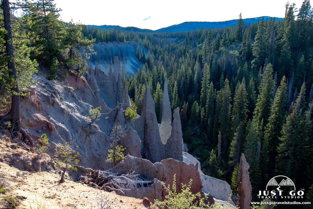
The Pinnacles Trail is a short, 0.8-mile (round-trip) hike that only climbs about 40 feet. It heads along some great views of 100-foot peaks that have been formed by volcanic ash and gases. When the eruption occurred about 7,700 years ago, Mount Mazama created large flows of pumice. As steam escaped, vents were solidified in place forming these pumice peaks.
The pinnacles are strikingly beautiful to look at. You actually don’t need to do the entire hike, but even just a short 0.25-mile trek down the trail will lead you to some great views of the Pinnacles. You won’t have views of the lake from here, but it’s totally worth doing!
The trailhead for the Pinnacles Trail is located at the Pinnacles Overlook at the end of Pinnacles Road.
CRATER LAKE NATIONAL PARK HIKING PERMITS
If you want to stay overnight in the backcountry, you need to obtain a permit. You can check out the National Park site on how to obtain permits for backcountry camping.
FURTHER INFORMATION ON CRATER LAKE NATIONAL PARK FROM JUST GO TRAVEL STUDIOS
- Ahead of your trip, be sure to download a copy of our guide for Crater Lake National Park. We cover the best hikes (with maps), what to pack, where to stay and much more!
- Other great blogs worth checking out on Crater Lake include Where to Camp in Crater Lake National Park, visiting Wizard Island and hiking the Watchman Peak Trail and Pinnacles Trail.
- When you get back, send us a photo and we’ll create a one of our custom, vintage-style posters, postcards and note cards that are personalized and made just for you!


