Located in Vermont’s Northeast Kingdom, Groton State Forest is Vermont’s second-largest state forest. At just over 26,100 acres, it’s just over half the size of Mount Mansfield State Forest. Groton State Forest is conveniently located near several large cities, contains seven state parks, several natural areas and many water bodies. Within Groton State Forest you are sure to find something to do if you love the outdoors, whether it be hiking, camping, swimming in one of the many lakes or just scouting out and looking for some of the plentiful wildlife.
Though Groton State Forest isn’t particularly large, doing a bit of pre-planning ahead of your trip will really help make sure you are able to do the most with your time in the area. We put together this guide to help you navigate your way through this amazing place and will cover what you need to know about the best hikes in the forest, camping and what to see and do when visiting Groton State Forest!
GROTON STATE FOREST HISTORY
Groton State Forest was established in 1919 after the area was logged heavily. After most of the trees were removed, the local logging industry shrunk rapidly. As land was acquired, planting trees started in earnest. The Civilian Conservation Corps contributed greatly in the 1930’s, helping to both restore the forest and put in place the infrastructure that is here today, including the roads, trails and fire towers.
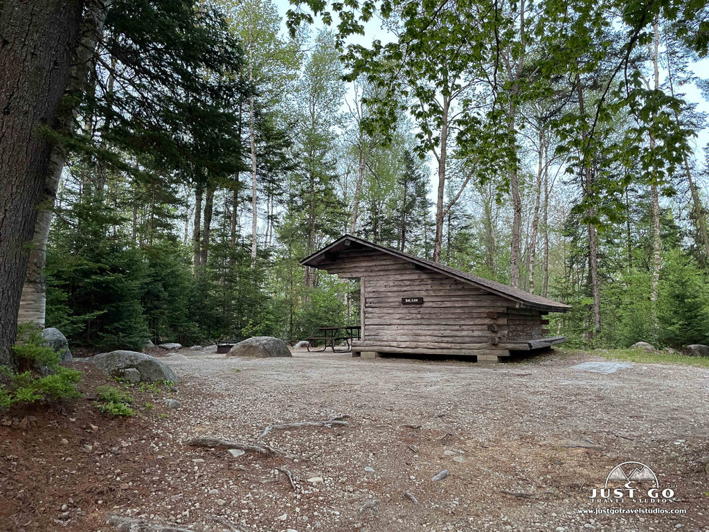
Today, Groton State Forest encompasses 26,164 acres and is managed by the Vermont Department of Forests, Parks and Recreation.
THINGS TO DO IN GROTON STATE FOREST

Groton State Forest map, courtesy of the Vermont Department of Forests, Parks and Recreation
If you like the outdoors, you’re sure to find something to do in Groton State Forest. Most of the activities in the forest don’t require advance planning (aside from camping), so you can pretty much pick what to do based on the weather and what you feel like doing that day.
When visiting Groton State Forest, our recommendations on the best things to do include:
Visiting a State Park
hile driving around the forest roads can be a blast, the facilities available at one of the seven state parks in the forest are amazing. The state parks you can visit include Stillwater State Park, New Discovery State Park, Ricker Pond State Park, Seyon Lodge State Park, Big Deer State Park, Boulder Beach State Park and Kettle Pond State Park. Most of these parks have camping and water access. Big Deer State Park, New Discovery State Park and Seyon Lodge State Park do not have access to a lake or a pond, but are worth visiting if you prefer to camp or hike. To figure out the right state park to visit, we recommend visiting the Vermont State Parks website. Be advised that while entry into Groton State Forest is free, entry into each park does require a day-use fee or a camping reservation.
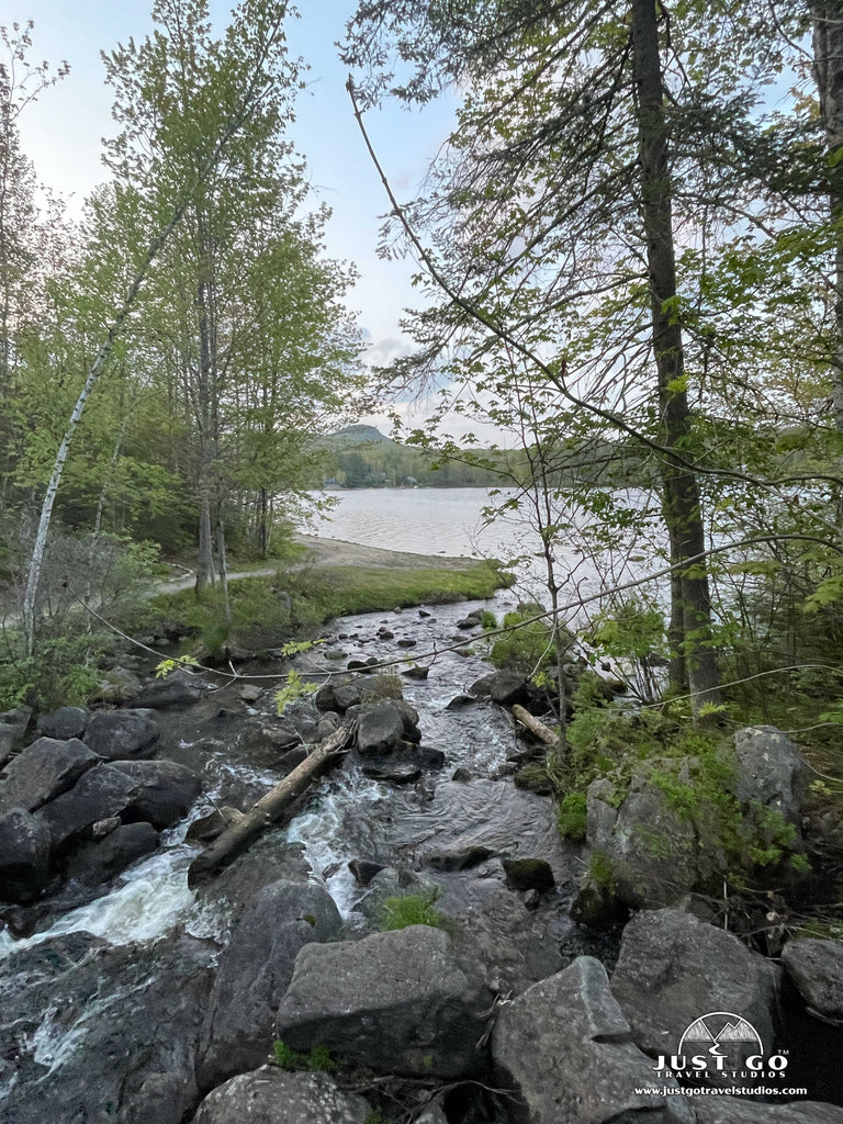
Groton Nature Center
Opened to the public in summer of 2023, the Groton Nature Center is a fully accessible center that includes exhibits on the local natural and cultural history. You can actually walk to the Nature Center from Big Deer State Park, Stillwater State Park and Boulder Beach State Park. The Groton Nature Center is located on Boulder Beach Road on the way to Boulder Beach State Park.
Swimming and relaxing on the beach
Ricker Pond (accessed by Ricker Pond State Park), Lake Groton (accessed via Stillwater State Park and Boulder Beach State Park) and Kettle Pond (accessed via Kettle Pond State Park) all offer great swimming. Lake Groton is the largest and most popular, but Ricker and Kettle Pond also offer a nice place to cool off in the summertime.
Boating
Boating is allowed at Ricker Pond, Lake Groton and Kettle Pond. All are accessed via the boat launches in the state parks.
Kayaking and paddling
Kayaking and paddling are also offered at Ricker Pond, Lake Groton and Kettle Pond. If you want to rent a canoe, you can do so at New Discovery State Park as well. You can also use a rowboat on Noyes Pond, accessed via Seyon Lodge State Park. Many of the state parks also offer canoe or pedal boat rentals.
Visit the CCC sites
If you are like us and into historical sites, this is for you! You can take a full day adventure working through the various parks and locations to see some of the remnants of the Civilian Conservation Corps, including camp remnants, shelters, a stone fire tower at the top of Owl’s Head, lean-tos around Kettle Pond and cabins and facilities in Stillwater and Ricker Pond State Parks. We recommend downloading the full guide to CCC sites in Groton State Forest.
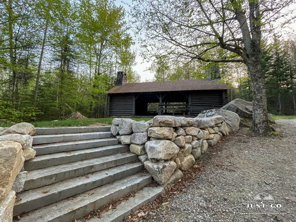
Owls Head Scenic View
Located at the end of Owls Head Scenic View Road (off Vermont Route 232 near New Discovery State Park, this viewpoint has terrific views of Lake Groton and Kettle Pond. There is a picnic area at the parking area too, which is a great place to stop and relax for an hour or so. To get to the viewpoint you will have to walk up a set of stone steps the climb in elevation about 100 feet, so just be prepared to do this if you want to get to the actual viewpoint.
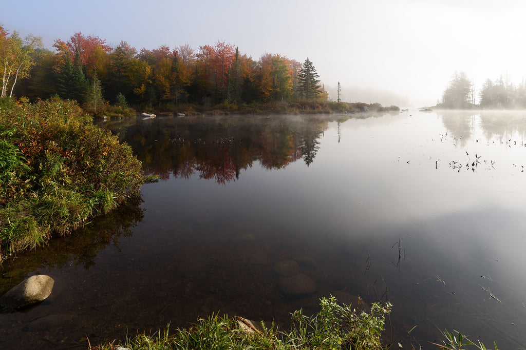
Marshfield Pond, image courtesy of King of Hearts
Hiking
Without a doubt, if you have the energy and the time, get out and do a hike in Groton State Forest. Of all the activities there are to do here, our favorite thing is to get out and explore by hiking a few of the trails. Whether you are in for a challenging hike that will take the better part of the day or want to do a few shorter hikes / walks, then Groton State Forest has something for you!
Many of the State Parks in the forest also have short walks. And if you are like us, even just walking around the camping area can be entertaining and beautiful. Many of the roads that go through the camping are a mile or more, and you can walk for as short or as long as you want. There’s also a variety of camping setups that are usually pretty interesting to look at, in addition to access to the day use areas and picnic spots.
The trail system near Big Deer State Park, New Discovery State Park, Boulder Beach State Park and Stillwater State Park is pretty intertwined, so feel free to combine some of our recommended trails!
Our recommendations for the Best Hikes in Groton State Forest (in ranked order by how enjoyable they are) are covered in the following section.
HIKING TRAILS IN GROTON STATE FOREST
Owls Head Trail
- Difficulty: Moderate
- Distance (round-trip): 3.6 miles
- Elevation gain: 540 feet
- Hiking time (approximate): 2 hours
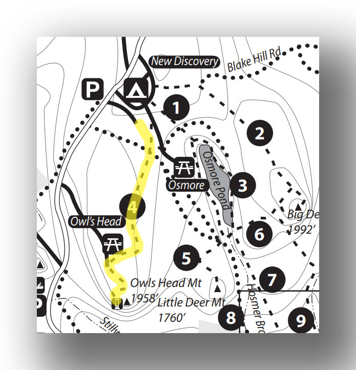
Owls Head Trail map, courtesy of the Vermont Department of Forests, Parks and Recreation
If you want a hike that isn’t overly difficult and hits the sweet spot for a moderate distance and great views, this is it! This moderate hike is 3.6-miles (round trip) has an elevation gain of about 540 feet. After leaving the parking area at New Discovery State Park, the trail heads south and climbs steadily uphill. You’ll reach a “false summit” before descending slightly and them finally climbing again to Owls Head Overlook via the rock steps built by the CCC. From here you’ll have views of the surrounding area, including Lake Groton and Kettle Pond. Be advised that there is a road that goes almost to the top as well, so while the trail may not be overly busy, the viewpoint can be occupied with a lot of people on a nice day.
The Owls Head Trail starts from New Discovery State Park in the parking area to the south of Route 232.
Big Deer Mountain Trail
- Difficulty: Moderate / Hard
- Distance (round-trip): 3.4 miles
- Elevation gain: 480 feet
- Hiking time (approximate): 2 hours
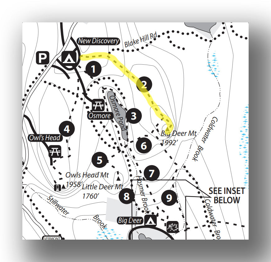
Big Deer Trail map, courtesy of the Vermont Department of Forests, Parks and Recreation
This moderate / hard trail is a good one if you have the desire for a bit more challenge and amazing views! The trail is 3.4-miles (round-trip) and climbs 480 feet. After leaving New Discovery State Park camping area (day-use fee required), the trail is flat for the first mile. At this point the trail ascends gradually and then sharply at the end as you approach the Big Deer Mountain summit. From here you’ll have terrific views of the surrounding ponds, but also of the White Mountains on a clear day!
The Deer Mountain Trail starts at the New Discovery State Park campground off Route 232.
Devil’s Hill Trail
- Difficulty: Moderate
- Distance (round-trip): 1.9 miles
- Elevation gain: 445 feet
- Hiking time (approximate): 2 hours
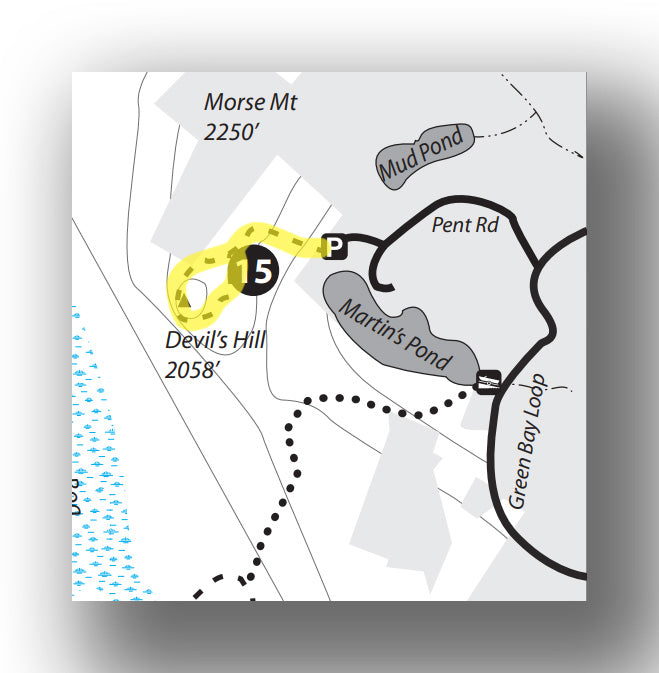
Devil’s Hill Trail map, courtesy of the Vermont Department of Forests, Parks and Recreation
This moderate trail is a great one if you find yourself on the northeast side of the forest. The trail is a 1.9-mile (round-trip) “lollipop” loop that leads to a great view after only about 445 feet of total elevation gain. After leaving the parking area, you’ll head west until you get to the junction where you can turn left or right. We recommend heading to the left for the slightly steeper ascent to the peak of Devil’s Hill (this way it’s easier on the knees on the way down). From the peak you’ll have great views of Martins Pond to the south and Peacham Pond to the northwest. Head back by going northwest from the peak (briefly) and then heading back east to the junction you passed earlier.
The Devil’s Hill Trailhead is located at the end of Devils Hill Road, which is reached from heading west from South Peacham on Maple Tree Lane to Green Bay Loop Road.
Big Deer and Little Deer Mountain Loop
- Difficulty: Hard
- Distance (round-trip): 6.3 miles
- Elevation gain: 1280 feet
- Hiking time (approximate): 4 hours
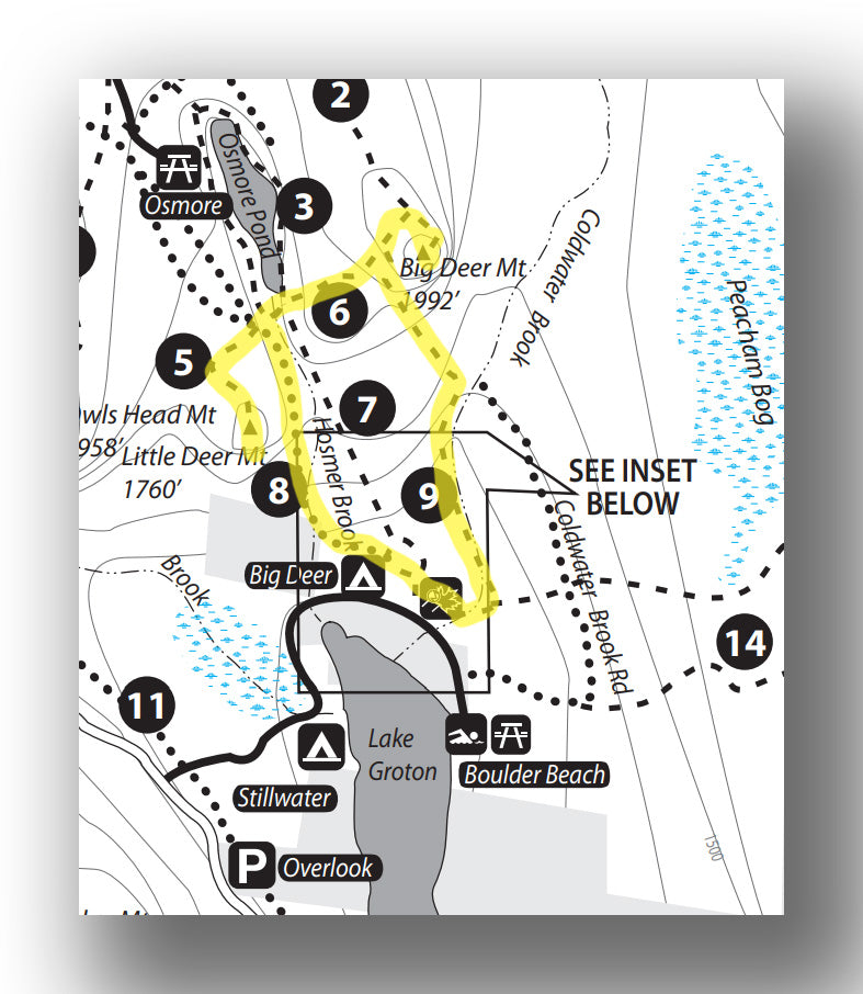
Big Deer and Little Deer Mountain Loop map, courtesy of the Vermont Department of Forests, Parks and Recreation
This hard hike combines several trails and multiple peaks. Plan on taking the better part of the day to do this hike, but it’s a great way to spend the day if you are camping in the area! This 6.3-mile (round-trip) hike climbs nearly 1280 feet in total. Starting from the Groton Nature Center, start by heading out on the Little Loop Trail and quickly pickup the Coldwater Brook Trail at the 0.5-mile point. At the 2.1-mile point, the trail meets up with the Big Deer Mountain Trail, where you will do the final climb to Big Deer Mountain. Take a break here before retracing your steps back on the Big Deer Mountain Trail, but this time do not turn back on the Coldwater Brook Trail but instead keep heading west and pickup the Little Deer Mountain Trail and climb to the peak. Return back from the peak about 0.3 miles and head south on the Telephone Line Trail and back to the Groton Nature Center.
The trailhead for the Big Deer and Little Deer Mountain Loop begins at the Groton Nature Center, located on the way into Boulder Beach State Park. You can also make a similar loop by starting from Little Discovery State Park.
Osmore Pond Loop
- Difficulty: Easy / Moderate
- Distance (round-trip): 4.0 miles
- Elevation gain: 320 feet
- Hiking time (approximate): 2 to 2.5 hours
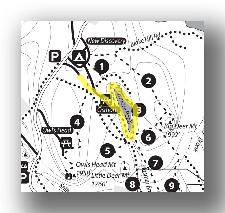
Osmore Pond Trail map, courtesy of the Vermont Department of Forests, Parks and Recreation
If you are up for a bit of a longer walk without too much elevation gain and a peaceful pond setting, this is for you! This easy-moderate trail is 4.0-miles (round-trip) with only about 320 feet of total elevation gain. Starting from the parking lot just south of New Discovery State Park, the trail heads to the southeast for about 0.8 miles before arriving at Osmore Pond. You can just check out the pond here or continue on the loop trail around the pond. This is a great trail for young families, as there are plenty of birds and wildlife in the pond to check out.
The Osmore Pond Loop Trailhead is just south of New Discovery State Park on Route 232.
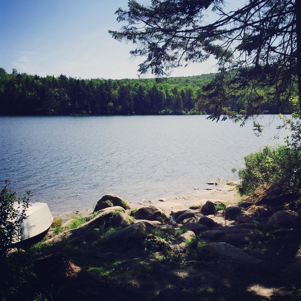
Osmore Pond, image courtesy of Dick Mansfield
Peacham Bog Loop Trail
- Difficulty: Moderate
- Distance (round-trip): 5.9 miles
- Elevation gain: 650 feet
- Hiking time (approximate): 3 to 3.5 hours

Peacham Bog Trail map, courtesy of the Vermont Department of Forests, Parks and Recreation
This moderate, 5.9-mile (round-trip) trail has a total elevation gain of 650 feet. Head east from the trailhead on the Peacham Bog Loop. The trail ascends for about 0.7 miles before flatting out all the way to the bog. At the 2.1-mile point, there is a bench and a spot to view Peacham Bog, with Devil’s Hill in the background. You can see wildlife here and it’s quite peaceful. To get back, you can continue on the loop or you can cut the hike short by returning back the way you came. While this trail will take you at least a half-day to complete, it’s a great hike to really get into the woods and see a different perspective without having too much elevation gain.
The Peacham Bog Trail starts at the Groton Nature Center, just before you get to Boulder Beach State Park on Boulder Beach Road.
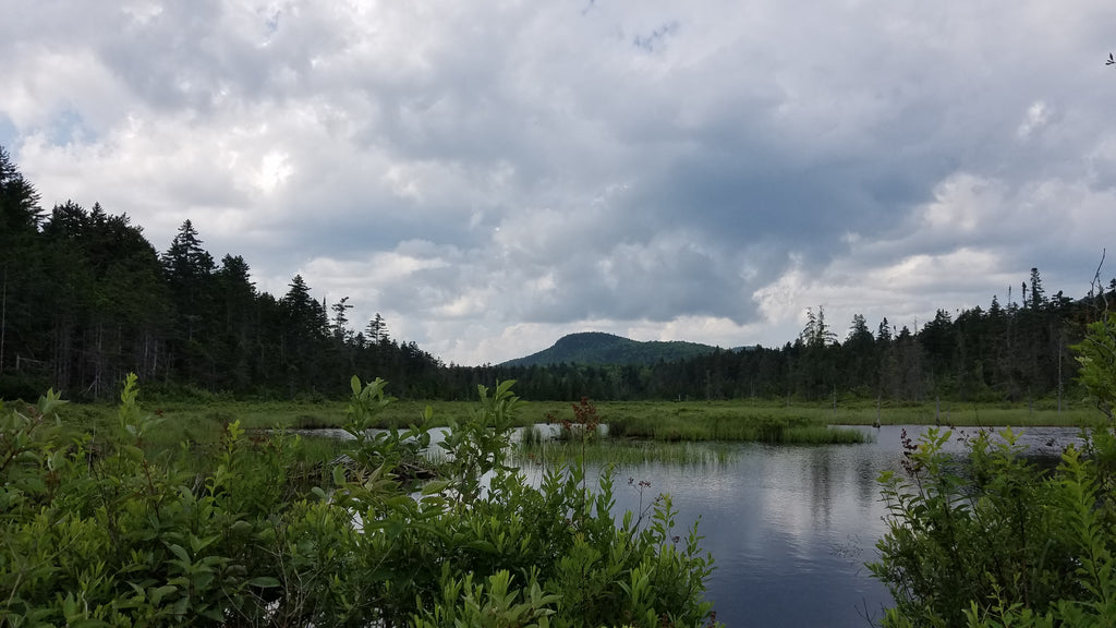
Devil’s Hill from Peacham Bog, image courtesy of Ascended Dreamer
Kettle Pond Loop Trail
- Difficulty: Easy / Moderate
- Distance (round-trip): 3.2 miles
- Elevation gain: 85 feet
- Hiking time (approximate): 2 hours
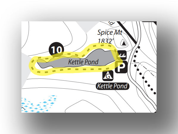 Kettle Pond Trail map, courtesy of the Vermont Department of Forests, Parks and Recreation
One of the easier trails, this 3.2-mile (round-trip) loop trail only climbs a total of 85 feet. While heading around Kettle Pond you’ll have a variety of views, with some wood planks and bridges to help you find your way around the pond. There can be a bit of mud, so waterproof shoes are recommended.
The Kettle Pond Loop trailhead starts at Kettle Pond State Park. You can start at the campground or at the day-use parking area.
Groton Nature Trail
- Difficulty: Easy
- Distance (round-trip): 0.6 miles
- Elevation gain: Minimal
- Hiking time (approximate): 30 minutes

Groton Nature Trail map, courtesy of the Vermont Department of Forests, Parks and Recreation
This short and easy hike (0.6-miles with minimal elevation gain) is a great way to stretch your legs. After leaving the Nature Center, continue on the short loop through the woods. You can pickup a trail guide at the Nature Center or by downloading the Groton Nature Trail guide here.
There are several other walks / hikes to consider and you can learn more about these using the Groton State Forest hiking map and guide.
HOW TO GET TO GROTON STATE FOREST AND OTHER TRAVEL INFORMATION
Groton State Forest is easy to get to. It’s located between Groton, VT and Marshfield, VT, about 15 miles due east of Montpelier. Of course there isn’t a direct route here, but the drive is beautiful.
- Here are directions from Montpelier, VT to Groton State Forest. This is about 25 miles and will take you about 40 minutes.
ENTRANCE FEES AND REQUIRED PASSES FOR GROTON STATE FOREST
There is no fee to enter into Groton State Forest, but day-use passes are required at each of the Vermont State Parks. Day use fees are generally $5 / person, with discounts given for children. You can also purchase an annual pass, which is a good option if you plan on visiting multiple state parks during your visit. A day-use pass is included with the camping fee.
GROTON STATE FOREST CAMPING
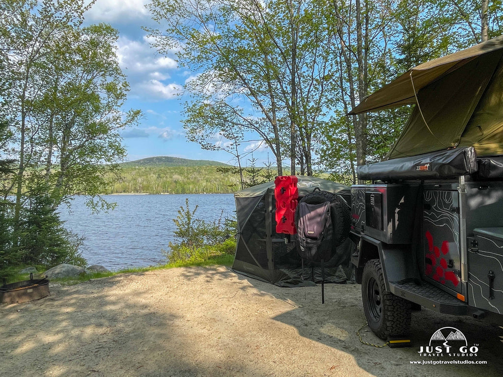
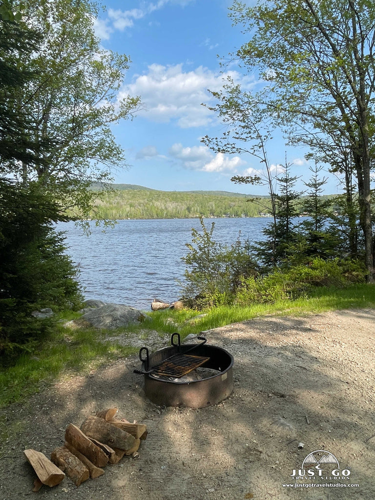
There are plenty of established campgrounds within Groton State Forest, but all are within the State Parks. Stillwater State Park, Ricker Pond State Park, New Discovery State Park and Big Deer State Park all have established campgrounds with bathrooms and services. Kettle Pond State Park has group / remote camping and Seyon Lodge State Park actually has overnight accommodations that are worth checking out as well.
If you are interested in backcountry and remote camping, then Groton State Forest has a number of great options for you. Remote camping is available on Osmore Pond as well as Kettle Pond, and you can find more details in the guide for remote camping in Groton State Forest.
BEST TIME TO VISIT GROTON STATE FOREST
Groton State Forest is great to visit anytime of year, but our favorite time is summer and fall when you can enjoy the water and perhaps the changing foliage. Spring is pretty, but it can be quite buggy. Most of the campgrounds don’t open until on or just before Memorial Day and the trails can be muddy before this time.
VISITING GROTON STATE FOREST IN THE WINTER
Groton State Forest is amazing in the winter. As long as you are prepared for hiking in the snow and ice, then you will have many if the trails to yourself! Just be sure you are prepared, and you will be in for a very quiet and special experience.
ARE PETS ALLOWED IN GROTON STATE FOREST?
Pets are allowed in Groton State Forest but must be leashed. They are not allowed in the swimming areas, so just be sure you check the signs around the parks before you bring your pet.
RELATED INFORMATION ON THE SURROUNDING AREA FROM JUST GO TRAVEL STUDIOS
- Be sure to check out our other blogs on Vermont public lands! We have a number of them, including a few on some local state parks that are worth checking out. One of the parks that is relatively nearby that is worth checking out is covered in our article on Things to Do in Lake Carmi State Park.
- Be sure to send us a photo or two when you get back and we’ll create a custom, vintage travel poster with your own personalized wording!


