Located near the end of the Kings Canyon Scenic Byway and Cedar Grove Village Road in the Cedar Grove area of Kings Canyon National Park is the Zumwalt Meadow Trail. This peaceful oasis in an otherwise rugged canyon is a must-do hike in the park.
Suitable for families with young children, this hike is a quick 2.4-mile jaunt. It has enough to keep everyone interested, including a stroll along the Kings River, a suspension bridge crossing, a walk through a boulder field and finally a view of Zumwalt Meadow that seems to come out of nowhere.

In addition to the hike, there is picnicking at the trailhead and options to extend the hike further.
Even though the official hike (which is a loop) has been damaged by recent flooding and determined to be unpassable, the now out-and-back trail is still well worth the trip and highly recommended.
ZUMWALT MEADOW TRAIL DETAILS
- Difficulty: Easy
- Distance: 2.4 miles (round-trip)
- Trail: Out-and-back
- Elevation gain: 154 feet
- Peak elevation reached: 5,059 feet
- Best time of year to hike: Early summer to late fall
- To beat the crowds: Arrive before 8:30 am or after 4:00 pm
- Footwear: Hiking boots
- Watch out for: Mosquitoes, sun exposure
- Restrooms: Located at the trailhead, but not on the trail
- Pets: Not allowed
- Time needed: 1 to 1.5 hours
Ahead of your trip, be sure to download our Kings Canyon National Park Itinerary. It is a 12+ pages of information to help you plan your trip, including great hikes, what to pack ahead of your trip, great things to do nearby and must-dos in the park.
ZUMWALT MEADOW HISTORY
Zumwalt Meadow is named after Daniel K. Zumwalt. Zumwalt was a local lawyer, who lived in Tulare, California. History is a bit sketchy and connections are hard to tie together. What is known is that Zumwalt was hired by the Southern Pacific Railroad as they worked to expand their empire and routes through California. However, it was through the work of Zumwalt and several other associates that General Grant National Park was set aside in 1890 to be protected forever. Whether or not the main purpose of that was to the ultimate benefit of the Southern Pacific Railroad (which can be argued) will never be known.
Whatever the purpose of the land being set aside, or who is to credit, what exists is a wonderfully pleasant hike along the Kings River for all of us to enjoy.
PARKING AND TRAILHEAD FOR THE ZUMWALT MEADOW TRAIL

Zumwalt Meadow Parking area map, courtesy of the National Park Service
Parking for the Zumwalt Meadow Trail is in a parking lot that is dedicated just to hikers and visitors to this area. It is about 4.5 miles-east of the visitor center on Cedar Grove Village Road. As you head to the end of the road, it will be on the right side (well before the end of the road and about 1.2 miles past the stop for Roaring River Falls).
- Directions from the Cedar Grove Visitor Center to Zumwalt Meadow (this is about 4.5 miles and till take between 10 and 15 minutes, depending on the traffic).
- Directions from Grant Grove Village to Zumwalt Meadow (this is nearly 34 miles and will take a little over an hour, and you should allow for plenty of time to take in the sights along the way).
There are about 30 parking spots for the trail and the picnic area. While some people do park on the road, when we were there, signs specified that this wasn’t allowed. This means that you could be waiting awhile for a spot if you come during peak times of the day. The trail takes about an hour, so on average you can plan on a spot opening up about every 2 minutes.
There are restrooms at the trailhead but none while out on the trail.
ZUMWALT MEADOW TRAIL: TRAIL SURFACE AND ACCESSIBILITY
- Trail surface. The trail starts off as packed dirt. After the bridge, you will walk through some roots and potentially some mud before going over large boulders. We were happy we had boots on, as it can be easy to twist an ankle if you aren’t careful.
- Accessibility. The trail is not wheelchair accessible, but it is flat for the first 0.3 miles and is a nice walk, even if you can’t go the full way.
It’s also important to note that the Kings River is known for causing drownings each year. Be careful and don’t go into the water, especially during the spring runoff.
PREPARATION FOR HIKING THE ZUMWALT MEADOW TRAIL
This is a short hike, but we still recommend bringing a few things with you:
- Water. Make sure you bring water. Though the trail is short, you can plan on getting thirsty after the climbing briefly in the rocks. Plus, the weather can be quite dry at this altitude and some of the trail is exposed.
- Hiking Boots. You can wear hiking boots or closed toed shoes. Since there is a bit of elevation gain, you’ll be glad you had the protection for your feet and ankles.
- First-aid Kit. Since some of the rocks are sharp, it’s possible that little people in your group will get a scrape. We recommend bringing a hiking first aid kit just in case.
HIKING THE ZUMWALT MEADOW TRAIL

Zumwalt Meadow Trail map, courtesy of the National Parks Service
The trailhead starts on the southern side of the parking lot. Right at the trailhead are several picnic tables. This was a popular spot to hang out and look at the South Fork Kings River. We enjoyed eating here before we headed out on the trail.

The trail starts off as dirt and is fairly flat. This part of the trail is wheelchair accessible, as long as it is dry. It is certainly a good hike for those who are using a cane or if you have kids that aren’t yet seasoned hikers.


The trail continues along the river as it descends about 50 feet. It is here that you’ll cross the wooden suspension bridge. Our kids especially loved this part, and it seemed to keep other kids interested as well!


At the end of the suspension bridge is a decision point. If you go to the right, you can continue to Roaring River Falls. To head to Zumwalt Meadow, turn left and head through the forest briefly.
After about 0.1 miles, you’ll see the small river crossing to the left of the trail that is closed. This is the “return” part of the loop. Plans are in place to repair this part of the trail.

Keep heading to the right and you’ll start to head uphill as you head through the granite boulders. This is an especially impressive area, as it shows the massive amount of shaping a simple rockslide can make to a landscape.


After heading alongside the granite cliffs, the trail descends into Zumwalt Meadow. From here you can take some amazing photos of the meadow before having to turn back and head the way you came in.


If desired, you can head 1.5 miles to Roaring River Falls. This will add 3.0 miles onto the hike if you make the round-trip hike. This is also a very quiet part of the trail-a stark contrast to most of the Zumwalt Meadow Trail.

ZUMWALT MEADOW TRAIL: TOP LIKES AND DISLIKES
Likes:
- Variety of Scenery. Being able to see the Kings River, a beautiful meadow and walk through the forest was really cool and kept it interesting.
- Suspension Bridge. Suspension bridges are always really cool and provide a nice break to the hike if anyone is getting bored.
Dislikes:
- Closed Portions. We love loop trails, and it was a bit disappointing that the loop was closed down. This extended the hike and also doubles the amount of foot traffic going over the same areas. Still, don’t let this dissuade you from going!
THINGS TO DO NEAR THE ZUMWALT MEADOW TRAIL
Cedar Grove Village Road is full of great stops, and the Zumwalt Meadow Trail is just one of them. Other attractions include:
- Head to the end of the road and hike the Mist Falls Trail. This is a challenging hike (at just over 8 miles round-trip), but it is totally worth the work. From here, you can also find backcountry hiking opportunities.
- The Cedar Grove Visitor Center is a great stop to learn about the park and ask questions of the rangers.
- Roaring River Falls is a short 0.3-mile (round-trip) trail that is highly recommended if you have a few minutes. Be ready to get a little wet, though! The mist from the waterfall is a perfect way to cool off on a hot day.
FURTHER INFORMATION ON KINGS CANYON NATIONAL PARK FROM JUST GO TRAVEL STUDIOS
- Ahead of your trip, we recommend downloading our Kings Canyon National Park Itinerary. Having a copy of this document can really help, since cell service in the park is non-existent and getting details on what to see and do can be a real challenge.
- Another blog to check out is our extensive article on What to See and Do in Kings Canyon National Park and our blog on the 6 Best Hikes in Kings Canyon National Park.
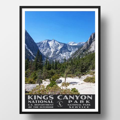
- If you like vintage posters, check out our Kings Canyon National Park WPA style poster.
- After you get back from your trip, send us a photo and we can turn that into a Custom, Vintage-Style Travel poster with your own customized wording!


